Does Navionics Work on Apple Watch
Interested in using Navionics on your Apple Watch but not sure how it works or if it’s compatible?
This article will answer all your questions about Navionics, including how it works, what devices it can be used on, and specifically, its compatibility with Apple Watch.
From downloading the app to navigating with your watch, we’ll cover the benefits and limitations of using Navionics on Apple Watch.
Read on to find out everything you need to know about this handy navigation tool.
Key Takeaways:
What is Navionics?
Navionics is a leading provider of boating and fishing charts, known for its collaboration with Garmin Italy Technologies in offering innovative solutions for marine navigation.
Through its partnership with Garmin Italy Technologies, Navionics contributes cutting-edge technology that enhances the overall marine navigation experience for enthusiasts worldwide. Navionics’ commitment to providing detailed nautical charts goes hand in hand with its dedication to constantly improving and updating its products. One of the standout offerings from Navionics is its exclusive SonarChart feature, which offers highly detailed and up-to-date bathymetry maps. These HD bathymetry maps provide unparalleled accuracy and clarity for boaters and anglers, making them an essential tool for navigating coastal waters and locating fish hotspots.
How Does Navionics Work?
Navionics operates by utilizing advanced technologies to create detailed nautical charts, including SonarChart, overlays, relief shading, and satellite imagery, ensuring accurate and up-to-date navigation data.
In terms of SonarChart, Navionics employs sophisticated sonar technology to map the depths of water bodies with remarkable precision. This feature allows for the generation of highly detailed maps that reflect the underwater terrain accurately. Overlays are used to supplement these charts with additional information such as navigational aids, port data, and points of interest, enriching the overall user experience.
Relief shading adds another layer of detail by providing topographical information, enabling sailors to visualize the underwater topography and coastal features with greater clarity. Meanwhile, the integration of satellite imagery into the charts offers comprehensive coverage, enhancing the geographical accuracy and helping sailors navigate with confidence.
What Devices Can Navionics Be Used On?
Navionics can be accessed on various devices, including GPS-enabled smartphones and tablets running on iOS or iPadOS, as well as compatible chartplotters certified by the Wi-Fi Alliance.
Users can easily utilize Navionics on their GPS-equipped smartphones and tablets, making it a versatile tool for on-the-go navigation. The seamless integration of Navionics with chartplotters meeting Wi-Fi Alliance standards ensures a smooth transition between different platforms, allowing boaters and sailors to access essential navigation tools effortlessly. Whether you’re out on the water with your smartphone or utilizing a dedicated chartplotter, Navionics offers a consistent user experience, providing detailed charts and real-time updates to enhance your boating adventures.
Smartphones
Navionics offers a dedicated boating app for smartphones, ensuring users can access GPS-based navigation tools on their iOS devices for on-the-go marine exploration.
With the Navionics app, boaters can enjoy the convenience of real-time positioning, ensuring they always know their exact location on the water.
One of the standout features is the ability to meticulously plan routes, taking into account obstacles, currents, and other vital factors for a seamless sailing or boating experience.
Users have access to comprehensive marine charts right at their fingertips, offering detailed information about water depths, tides, and more, enhancing their overall navigation capabilities.
Tablets
Navionics caters to tablet users through its boating app designed for iPadOS, enabling marine enthusiasts to leverage GPS capabilities for navigation and chart plotting on larger touchscreen devices.
With the expansive screen size of tablets, users can enjoy a more immersive experience when viewing detailed charts, marking waypoints, and customizing routes for their boating adventures. The advanced functionality of the Navionics app on iPadOS allows for seamless integration with other navigation instruments, enhancing safety and convenience on the water. Navigating through complex waterways becomes more intuitive with the intuitive touch controls and high-resolution display offered by the tablet interface.
Chartplotters
Navionics integrates seamlessly with certified chartplotters endorsed by the Wi-Fi Alliance, ensuring reliable connectivity and access to advanced navigation tools for marine enthusiasts.
By leveraging the compatibility of Navionics with these chartplotters, users can enjoy a plethora of benefits that enhance their boating experience. One of the standout features is SonarChart, which provides detailed bathymetric data for accurate depth information and underwater contours, crucial for safe navigation. The auto guidance feature simplifies route planning, optimizing journeys and saving time on the water. The ability to access and contribute to community edits fosters a collective knowledge-sharing environment, improving chart accuracy and helping fellow sailors navigate with confidence.
Computers
Navionics extends its navigation solutions to computers, enabling users to access GPS-based mapping software for detailed marine charting and route planning on desktop or laptop systems.
By incorporating its renowned technology into computer platforms, Navionics give the power tos boaters and sailors with a seamless transition from their handheld devices to a larger screen interface. This integration enhances the user experience by providing a comprehensive suite of navigation tools for precise route customization and strategic analysis, all within the convenience of their desktop or laptop. The utilization of GPS technology further ensures accuracy in charting marine areas, while the mapping software delivers rich visual details essential for safe and efficient navigation. Users can now leverage the power of Navionics’ robust solutions on their computers for enhanced maritime adventures.
Smartwatches
Navionics introduces support for smartwatches, allowing users to access GPS-powered navigation tools directly from their wrist, providing a convenient and hands-free navigation experience while on the water.
With this integration, Navionics enhances the functionality of smartwatches, turning them into powerful aids for sailors, boaters, and water sports enthusiasts. The compatibility of Navionics with smartwatches enables users to view detailed charts, plan routes, and monitor real-time information seamlessly on a compact device strapped to their wrist. This innovation revolutionizes the way marine navigation is carried out, offering users unparalleled convenience, efficiency, and safety features tailored for the dynamic nature of aquatic environments.
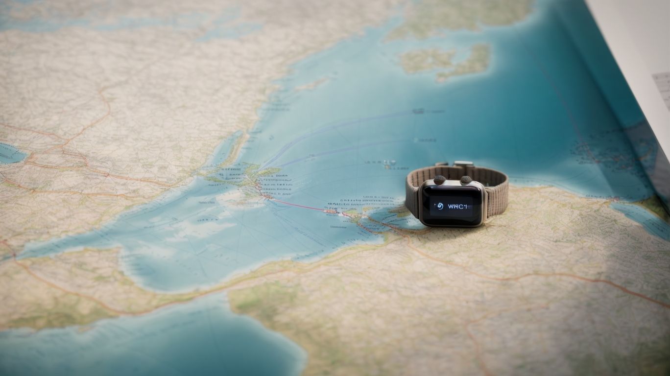
Is Navionics Compatible with Apple Watch?
Navionics offers a dedicated app for Apple Watch, ensuring seamless integration with iOS devices and prioritizing user privacy and data security.
The specialized Navionics app for Apple Watch enhances the user experience by providing essential navigation tools directly on your wrist. Whether you are sailing, boating, or engaging in any water-related activities, having access to accurate maps and real-time data on your Apple Watch can be incredibly convenient.
Navionics places a high emphasis on privacy and data security within their app ecosystem. By following strict security protocols and encryption methods, Navionics ensures that your location, routes, and personal information remain protected while using the app on your wearable device.
Navionics App for Apple Watch
The Navionics app for Apple Watch extends the navigation capabilities to users’ wrists, offering GPS functionality and enhanced app privacy features for seamless marine exploration.
Users can easily access crucial features like real-time GPS tracking, route planning, and waypoint marking directly from their Apple Watch, ensuring they stay on course even when away from their phone or other devices.
The app’s privacy enhancements allow users to share their location securely with select contacts or keep their movements discreet when exploring unfamiliar waters.
With a user-friendly interface optimized for the Apple Watch’s small screen, navigating through charts, checking tides, and monitoring weather conditions becomes effortless and efficient.
Navionics Compatibility with Apple Watch Models
Navionics ensures broad compatibility with various Apple Watch models, enabling users to access GPS functionality and navigation tools across different versions of the wearable device.
One of the key aspects of Navionics is its seamless integration with Apple Watch, offering a user-friendly interface that caters to the needs of a wide range of users. With Navionics, Apple Watch users can effortlessly access essential GPS features, such as detailed maps, route planning, and real-time location tracking, enhancing their outdoor adventures with precise navigation tools.
Whether you own the latest Apple Watch Series 7 or an older model like the Apple Watch Series 3, Navionics ensures a consistent and reliable experience, making it a valuable companion for hikers, sailors, or anyone in need of location-based services on the go.
How to Use Navionics on Apple Watch?
Utilizing Navionics on Apple Watch involves downloading the app, pairing it with a compatible device, and leveraging GPS-based navigation tools for on-the-go marine exploration.
Once you’ve downloaded the Navionics app on your Apple Watch, the next step is to pair it with a compatible device. The seamless integration allows your watch to display real-time location data, including depth contours and navigational aids, right on your wrist.
Exploring the waters becomes a breeze with the user-friendly interface that enables easy access to various navigation features. Tap and swipe your way through chart layers, mark waypoints, and create routes with just a few simple gestures.
Whether you’re a seasoned sailor or a novice boater, the intuitive controls of Navionics on Apple Watch make marine navigation effortless and enjoyable.
Downloading the Navionics App
To begin using Navionics on Apple Watch, users need to download the dedicated app from the App Store, ensuring access to GPS navigation tools and marine charts on their wearable device.
Once the Navionics app is successfully downloaded from the App Store, users can open the app on their Apple Watch. The next step involves setting up the app by allowing necessary permissions, such as location access, to ensure accurate GPS tracking.
After the setup is complete, users can explore the app’s functionalities, including route planning, real-time weather updates, and tracking their movements on the water. The app’s user-friendly interface makes it easy to navigate through different features, allowing users to customize settings according to their preferences.
Pairing with a Chartplotter
Users can enhance their navigation experience by pairing Navionics on Apple Watch with a compatible chartplotter certified by the Wi-Fi Alliance, enabling seamless synchronization of navigation data and route planning.
By connecting the Navionics app on their Apple Watch to a certified chartplotter, boaters can benefit from a streamlined approach to navigation. This integration allows users to conveniently access real-time updates and charts on their wearable device, providing them with essential information at their fingertips.
The compatibility between Navionics and certified chartplotters endorsed by the Wi-Fi Alliance ensures that all data, including waypoints, tracks, and routes, stays consistent across devices, eliminating the need for manual input duplication.
Navigating with Apple Watch
Navigating with Navionics on Apple Watch offers users real-time GPS data and navigation assistance, ensuring accurate route tracking and on-the-go access to marine charts and points of interest.
Users can easily view their location on the water in real-time, track their journeys efficiently, and receive dynamic navigation features right on their wrist. With Navionics on Apple Watch, sailors, fishermen, and boaters alike can optimize their routes, avoid obstacles, and explore new areas confidently. The seamless integration of marine charts and points of interest provides comprehensive information at a glance, aiding in safe and enjoyable navigation experiences.
What are the Benefits of Using Navionics on Apple Watch?
Using Navionics on Apple Watch offers users convenient and hands-free navigation, real-time data updates, and the ability to personalize their marine exploration experience.
By having access to Navionics on their Apple Watch, boaters can enjoy the freedom of navigating without having to constantly check their phones or dedicated GPS devices. The convenience of receiving real-time data updates directly on their wrist ensures that users stay informed about changing weather conditions, tide levels, and other important navigational information instantly.
With Navionics, individuals can personalize their settings to tailor their navigation preferences based on their specific needs and preferences. Whether it’s setting up favorite routes, customizing waypoints, or adjusting map views, users have the flexibility to optimize their marine exploration experience for utmost efficiency and enjoyment.
Convenient and Hands-free Navigation
Navionics on Apple Watch provides users with a convenient and hands-free navigation experience, allowing for seamless marine exploration without the need to constantly handle a device.
By utilizing the Navionics app on their Apple Watch, boaters can easily glance at their wrists to access real-time navigational information, such as GPS coordinates, routes, and waypoints, without interrupting their activities. The user-friendly interface of Navionics ensures that crucial data is displayed clearly and intuitively, enhancing safety and efficiency on the water.
The intuitive controls of the Apple Watch enable users to zoom in or out, set waypoints, and track their progress with simple gestures, freeing up their hands for crucial tasks like steering the boat or adjusting sails. This hands-free operation not only streamlines navigation but also enhances the overall boating experience by minimizing distractions and maximizing convenience.
Real-time Data and Updates
Navionics on Apple Watch delivers real-time data and updates to users, ensuring access to current navigation information, marine charts, and point-of-interest data for well-considered choices.
Having access to up-to-date information is crucial for sailors, fishermen, and boaters alike. With Navionics on Apple Watch, users can stay informed about changing water conditions, harbor details, and navigational hazards. Timely updates play a significant role in ensuring accurate route planning and safe navigation. Real-time data helps users make informed decisions on the water, whether it’s choosing the best fishing spot or avoiding potential obstacles during a pleasure cruise.
Personalization and Customization
Navionics on Apple Watch allows users to personalize and customize their marine exploration experience, tailoring navigation settings, map views, and points of interest to suit their preferences.
Users can adjust navigation settings such as route preferences, safety settings, and depth contours to cater to their specific needs. They have the flexibility to customize map views to focus on details like currents, wind forecasts, and marine services.
Changing points of interest allows users to highlight favorite fishing spots, nearby marinas, or important landmarks for a more personalized experience. By fine-tuning these options, users can enhance their interaction with the app and engage more deeply with their marine surroundings.
Are There Any Limitations to Using Navionics on Apple Watch?
While Navionics on Apple Watch offers numerous benefits, users may encounter limitations such as restricted screen size and reliance on an internet connection for real-time data updates.
These constraints can significantly impact the user’s ability to view detailed navigation information effectively on the smaller screen of the Apple Watch. Screen size limitations may lead to difficulties in interpreting complex maps or small text, potentially hindering navigation accuracy.
The reliance on internet connectivity for data updates can pose challenges when navigating areas with poor signal reception or when the user is offline. Without real-time updates, users may experience delayed information, which could affect decision-making and route planning.
In scenarios where precise navigation is crucial, the dependence on both screen size and consistent internet access may limit the overall effectiveness of using Navionics on an Apple Watch.
Limited Screen Size and Functionality
One limitation of using Navionics on Apple Watch is the constrained screen size and functionality, which may impact the visibility and usability of navigation tools and marine charts on the wearable device.
Due to the smaller screen size of the Apple Watch, users may face challenges in viewing detailed marine charts and navigation data effectively. The limited screen real estate can make it difficult to have a comprehensive overview of the surrounding waterways and obstacles.
- As a result, strategies need to be implemented to optimize the user experience.
- One crucial approach involves simplifying the interface, focusing on essential information, and utilizing clear, easily readable fonts and icons.
- Leveraging interactive features like zooming and scroll gestures can help users access specific areas of interest within the limited display space.
Dependence on Internet Connection
Another limitation of using Navionics on Apple Watch is the reliance on an internet connection for real-time data updates, which may pose challenges in areas with limited or unstable connectivity.
When venturing into remote locations or offshore, where network signals may be weak or non-existent, this dependency on a stable internet connection can significantly hinder the user experience.
One workaround to mitigate this issue is to pre-load maps and data while still in an area with strong connectivity. By doing so, the stored information can be accessed offline, helping users navigate even when they are out of range.
Considering a wearable GPS device that does not require continuous internet connectivity might be a more reliable option for those frequently exploring areas with poor signal strength.
Conclusion
Navionics on Apple Watch offers a versatile solution for marine navigation, providing users with real-time updates and customizable features to enhance their boating and fishing experiences.
One of the key benefits of using Navionics on Apple Watch is the convenience of having real-time updates at your fingertips. This feature allows boaters and fishermen to stay informed about changing weather conditions, water depths, and navigational hazards, improving safety on the water. The customizable features of Navionics enable users to tailor their navigation experience to suit their individual preferences and needs, making it a highly personalized and effective tool.
It’s important to note that the small screen size of the Apple Watch may limit the amount of information that can be displayed at once, potentially leading to a less detailed view of navigation charts. Despite this limitation, the portability and ease of access offered by Navionics on Apple Watch make it a valuable asset for anyone navigating the waters.
Frequently Asked Questions
Does Navionics Work on Apple Watch?
Yes, Navionics works on Apple Watch. The Navionics app is compatible with Apple Watch and can be downloaded from the App Store.
What features can I access on Navionics with my Apple Watch?
You can access basic navigation features such as tracking your route, viewing your current location, and marking waypoints on Navionics with your Apple Watch.
Can I use Navionics on my Apple Watch without an internet connection?
Yes, Navionics can be used on your Apple Watch without an internet connection. However, you will need to download the necessary maps and charts beforehand.
Is Navionics on Apple Watch accurate?
Yes, Navionics on Apple Watch uses GPS technology to provide accurate location and navigation data.
Can I customize the Navionics app on my Apple Watch?
Yes, you can customize the Navionics app on your Apple Watch by selecting which data fields you want to display and adjusting the map zoom level.
Do I need to have the Navionics app open on my iPhone for it to work on my Apple Watch?
No, you do not need to have the Navionics app open on your iPhone for it to work on your Apple Watch. The app can run independently on your watch.